Waterlevels as a service

We want to help companies and developers to automate their processes in regards of water level data and notification management. We provide our  Data as a Service  in an easy, reliable and fast way. Check out our API!

API access

Our REST API provides programmatic access to read and write historic, current, forecast waterlevel data, station meta data, register for warning notifications and many more. Follow these steps to get started:
  1. Get a free test-account by writing to office@sobos.at
  2. Call e.g. https://api.pegelalarm.at/api/station/1.1/list?qStationName=Linz
  3. Process the response. An example is shown below
    				{
        "status": {
            "code": 200
        },
        "payload": {
            "stations": [
                {
                    "name": "Donau / Linz / at",
                    "commonid": "207068-at",
                    "country": "Österreich",
                    "stationName": "Linz",
                    "water": "Donau",
                    "region": "Oberösterreich",
                    "latitude": 48.306915712282,
                    "longitude": 14.284689597541,
                    "positionKm": 2135.17,
                    "altitudeM": 247.74,
                    "defaultWarnValueCm": 550.0,
                    "defaultAlarmValueCm": 630.0,
                    "data": [
                        {
                            "type": "height in cm",
                            "value": 350.0,
                            "requestDate": "29.11.2020T20:37:35+0100",
                            "sourceDate": "29.11.2020T20:30:00+0100"
                        }
                    ],
                    "trend": 10,
                    "situation": 10
                }
            ]
        }
    }					
    				

Documentation

Please refer to our documentation on Github to learn about our data access possibilities.

Pricing

Data retrieval is free for science projects and during development phase. Our prices depend on ...

  • the services you need
  • your pricing strategy
  • the number of users you provide data to
  • your data request frequency

CSV download

We also provide data on personal request in CSV format. Write us an email that describes what you need (river name, gauge name, data start and end point).

Integrate FloodAlert into your website

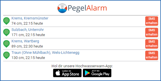
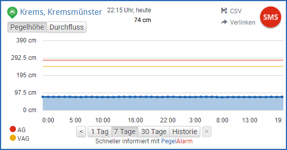
A gauge's waterlevel <iframe/>

Use this iframe to integrate the waterlevel trend of a gauge into your website.

An area's gauge list <iframe/>

Use this iframe to integrate a list of gauges of an area into your website.

Country flood severity <img/>

Use these images that show a country's flood severity situation on your website.

Data sources

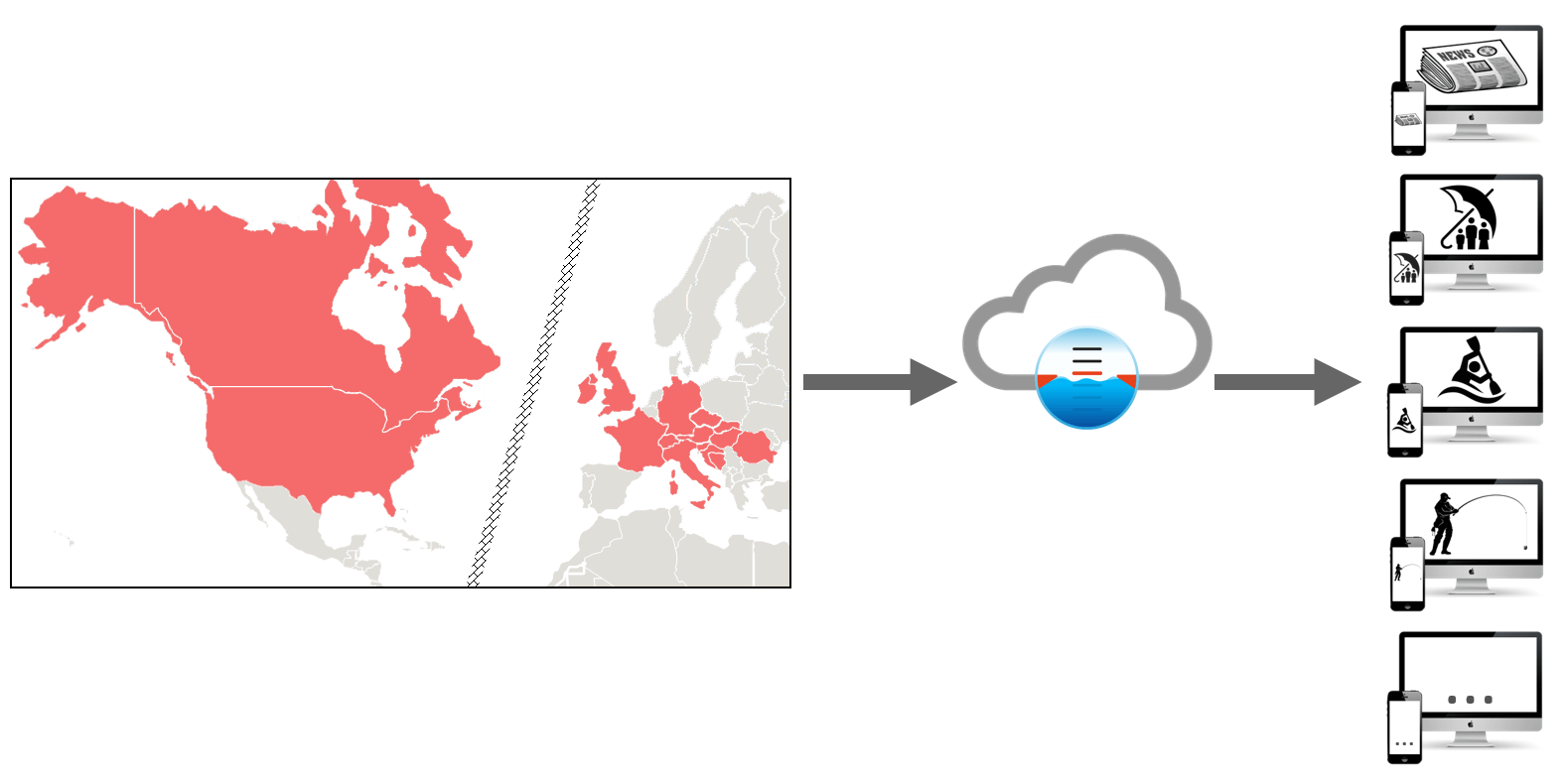
Our system manages water levels, discharges and gauge data from about 30,000 gauges and measuring stations. It automatically collects current, past and forecast data from over 40 data sources continuously from Argentina, Belgium, Bosnia & Herzegovina, Brazil, Bulgaria, Germany, Finland, France, Guam, Ireland, Italy, Canada, Kosovo, Croatia, Luxembourg, Netherlands, Norway, Austria, Paraguay, Puerto Rico, Romania, Sweden, Switzerland, Serbia, Slovakia, Slovenia, Taiwan, Thailand, Czechia, Hungary, Uruguay, United States, United Kingdom.

Get the FloodAlert App - Water level and flood warning app

We want to thank the following authorities that provide their data to allow a flood information and alert system like ours:

Argentina
Austria
Belgium
Bosnia & Herzegovina
Canada
Czechia
Croatia
Finland
France
Germany

Let us manage your gauge data

We would love to also manage your water level, flow and gauge data.
Your benefits

  • Data management
  • Alert notifications
  • High availablility
  • Apps for iOS, Android, Web
  • Support by our team

Don't hasitate: Call us or drop us an email!

Get the FloodAlert App - Water level and flood warning app

Our cooperation partners

We are working with numerous partners who support us in what we do. This is where we want to thank them!